Switch off GPS and the ship still has one peculiar landmark: gravity. Not 'down', which is not terribly useful for finding Australia, but tiny changes in how strongly Earth pulls from one patch of ocean to the next. Q-CTRL used those changes as terrain.
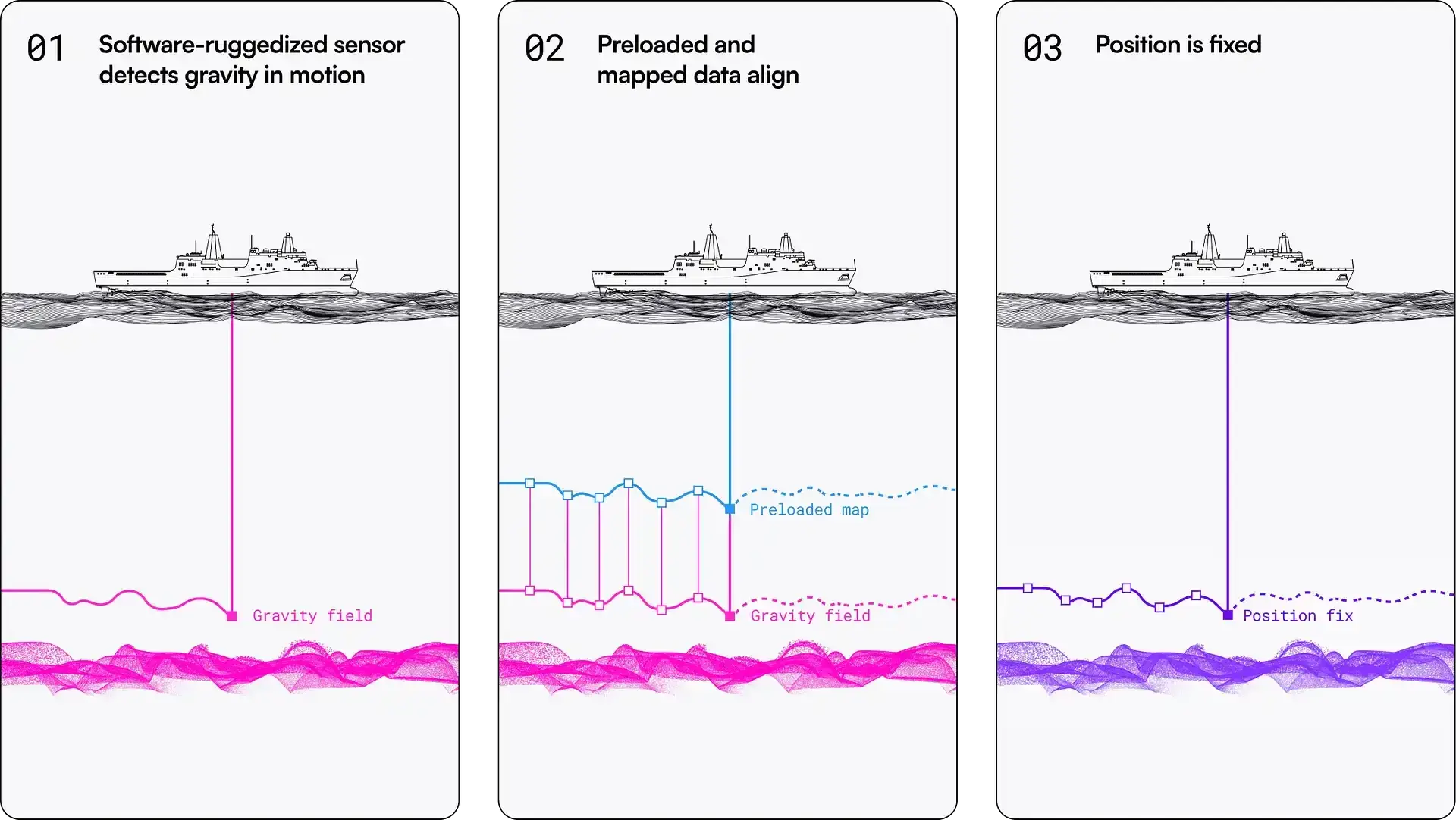
Calling it quantum GPS would make the story simpler and the engineering wrong. The gravimeter never produces latitude or longitude. The ship's inertial system keeps doing the navigation; the gravity measurement gives it an occasional argument about where that navigation has wandered.12
In the technical manuscript, that loop corrected navigation across an 83 km maritime trajectory with GNSS excluded from the measurement chain and delivered bounded positioning at roughly nautical-mile level.2
INS drifts
INS already works in the dark. Accelerometers and gyros do not need satellites, radio towers or a view of the sky. Their weakness is arithmetic: tiny measurement errors get integrated again and again.
An accelerometer bias first corrupts velocity, then position. A gyro that is slightly wrong about attitude lets a piece of gravity masquerade as motion. Leave that alone for long enough and the coordinates can look beautifully precise while describing the wrong patch of sea.24
The escape hatch is that Earth is lumpy. Different rock and seafloor structures produce small gravity anomalies, and satellite altimetry has been used for years to turn those patterns into global marine-gravity grids.6
Think terrain recognition, not a beacon. If a run of gravity highs and lows looks like one patch of the stored map, the filter gets a position clue it can use against inertial drift.
So Q-CTRL removes satellites from the live navigation link, not from the entire history of the data. The map used for matching can itself be satellite-derived.26
83 kilometres
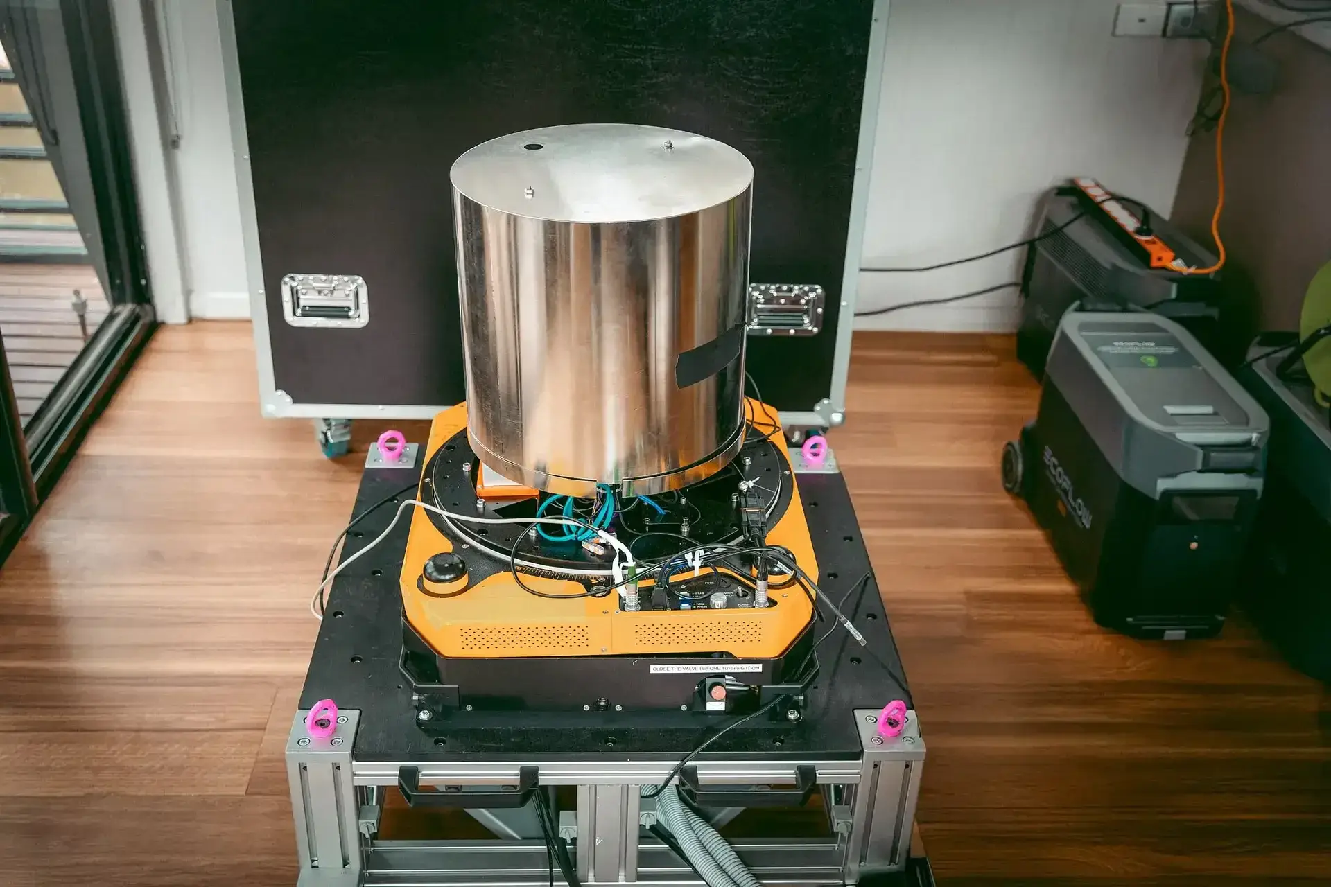
For the trial, all of this went onto a 29 m surface vessel.2 The gravimeter itself is already hybrid: atoms provide the long-term reference while a classical accelerometer helps bridge the ugly motion of a real boat. A separate navigation-grade IMU runs the inertial solution.2
The cabin was not turned into a floating metrology lab. No dedicated environmental stabilization, no special calibration regime. The researchers ran matching traversals first with a gimbal and then strapdown, with the instrument attached directly to the moving vessel.2
A boat is a rude place to measure gravity. It heaves, pitches, rolls and vibrates while the signal of interest is tiny. Strapdown means accepting that insult rather than mechanically hiding from most of it. Heave, roll, pitch and vibration are enormous compared with the small gravity anomalies the system is trying to recover. A gimbal physically removes some of that motion. Strapdown operation leaves much more of the separation job to sensing and software.
Q-CTRL reports comparable performance between the two configurations on the tested traversals.2 That does not mean a quantum gravimeter can now be bolted anywhere on any ship. It means operation without a dedicated gyrostabilized platform worked under the conditions of this trial.
Not the first ship
Q-CTRL's “world's first” only survives with a fairly precise boundary.1
The sea part is not new. A French team published shipborne atom-interferometry gravimetry in Nature Communications back in 2018.3 The catch, and the reason that paper still matters here, is its gyro-stabilized platform. The hardware worked hard to keep the sensor pointed correctly while the ship misbehaved.3
Birmingham then removed that comfort. Its quantum gravity-gradient sensor operated strapdown on a vessel, including at sea.5 But the team's 2025 IEEE/ION paper was careful about what it had not done yet: this was sensor deployment on a moving platform, not a finished alternative-navigation chain. Integration and filtering still sat on the roadmap.4
The defensible novelty in Q-CTRL's manuscript is narrower and more useful. The authors claim the first published demonstration of gravity map matching with a quantum gravimeter and a navigation chain fully independent of GNSS, plus the first same-instrument comparison of gimbaled and strapdown mobile quantum gravimetry.2
One other brake on the superlatives: the Q-CTRL manuscript is currently an arXiv preprint. We can inspect the method and numbers; peer review has not happened yet.
One mile
Q-CTRL highlights positioning accuracy of about one nautical mile, roughly 1.85 km, across the mission.1 Beside a healthy phone GPS, 1.85 km sounds awful. But that is the wrong contest.
Nobody should choose this over healthy GNSS because one nautical mile sounds more futuristic. Its value appears after GNSS is gone: the gravity match gives the INS something that does not share the same accumulating error.2
The useful word in the paper is bounded. An unaided INS can keep printing a very precise-looking coordinate while moving steadily away from reality. Gravity map matching gives it another external constraint and keeps the error within an envelope.2
The 70× number in the paper is easy to misuse. It comes from a 56-hour stationary test where atomic referencing reduced long-term sensor drift versus the classical channel.2 It does not mean the boat suddenly knew its position 70 times better.
Two modes
Then the researchers changed jobs without changing the instrument. For gravity surveying, GNSS came back. This time it supplied reference position while the team judged the quality of the gravity measurements themselves.2
Trials reached conditions up to Sea State 4. The authors report mGal-level agreement with gravimetric maps and sub-mGal repeatability and stability.2 They also report resolving anomalies down to an along-track scale of roughly 300 m, much finer than the effective spatial wavelength of the satellite map used for navigation.2
The same box is doing two different experiments:
- in navigation mode, the map already exists and measured gravity corrects the INS;
- in survey mode, GNSS provides reference position while the instrument measures gravity finely enough to build or check better maps.2
That dual use hints at systems that could eventually improve the data later missions depend on. The preprint does not yet demonstrate an autonomous fleet continuously maintaining a global map in service.
The map stays
So “GPS-free” survives the fact check, with an asterisk. The correction does not arrive over radio during the run. An onboard gravity map cannot be jammed in the way a GNSS receiver can lose or accept a bad satellite signal.1
Maps have their own failure modes. Resolution may be poor. Two stretches may look too similar. A geologically bland area gives the matcher less to grab. And none of this excuses a bad INS, bad motion estimate or bad filter.24
That is the useful catch. A navigation system can remove live external infrastructure while still depending on information prepared before departure.
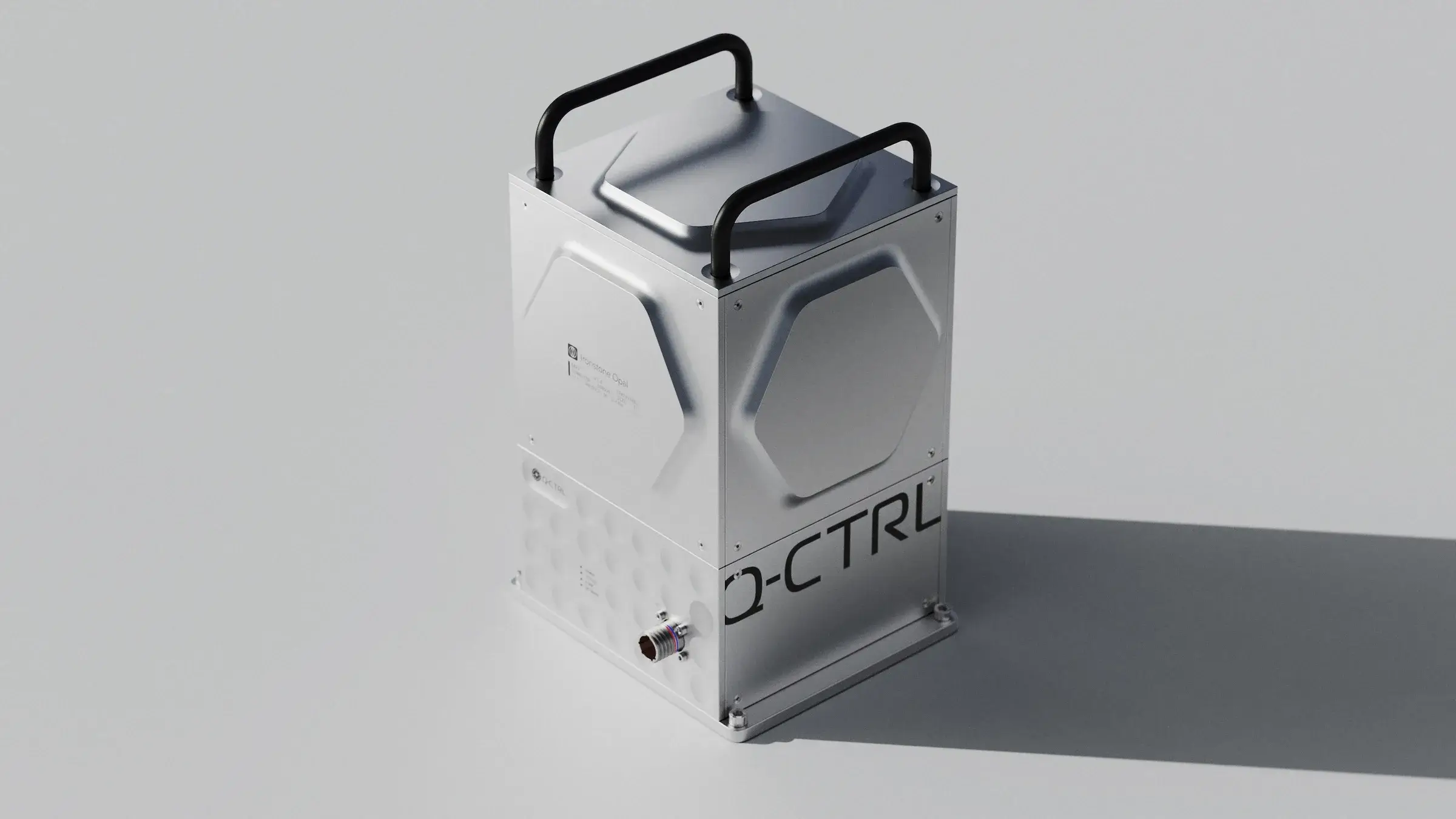
The gravimeter is not an exotic GPS replacement. Its job is smaller and more believable: add a physically different reference to an inertial system that would otherwise keep drifting.
Q-CTRL removed GNSS from the navigation run. It did not remove prior knowledge.
The map stayed onboard, quietly doing the part that makes a gravity reading useful for position.